STUDY for the TODALSS Test with these helpful slides!
***How did the U.S. get the shape we know it as today?
***What people were instrumental in making that happen?
***What events led to each portion?
***How did it impact the people who were there along with ***the people who moved onto it?
***How are we interconnected with the places we live?
Understanding maps with TODALSS
Create and use various kinds of maps, including overlaying thematic maps, of places in the United States; incorporate the “TODALSS” map basics, as well as points, lines, and colored areas to display spatial information. (7.3.1.1.1)
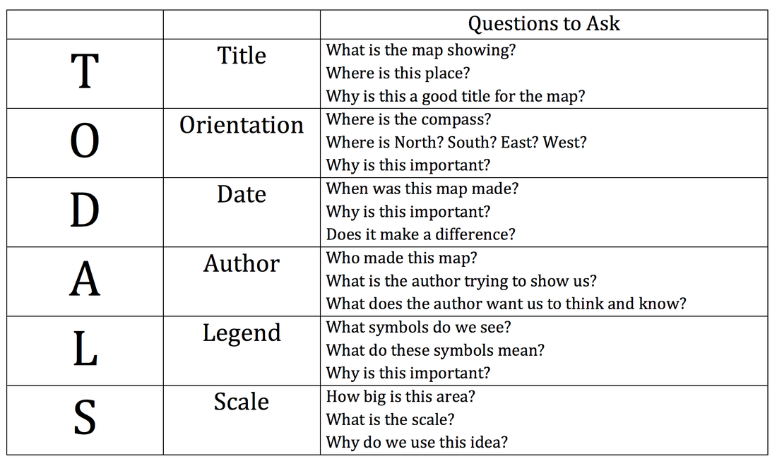
What's the last "S" for? SOURCE: Where did the data for the map come from?
How did the United States get its shape? |
You can see this process in 141 different maps
Describe the processes that led to the territorial expansion of the United States, including the Louisiana Purchase and other land purchases, wars and treaties with foreign and indigenous nations, and annexation. (7.4.4.18.1)
A good summary of how the U.S. got its shape |
|
Lots of details in this animated map video(and some epic music to give it some drama)
|
|
A few more videos to help you...
|
|
|
|
How different parts became part of the U.S.
What does this painting say about the attitudes and impacts of westward expansion?
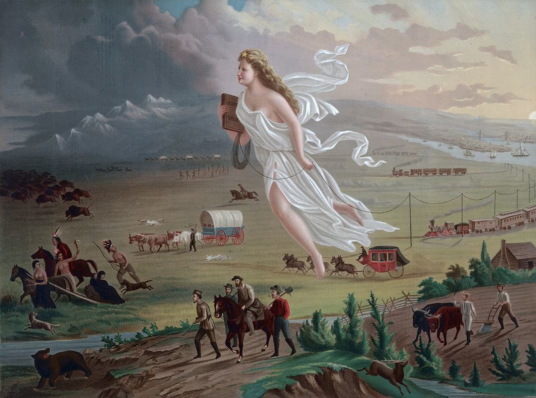
"American Progress" painting by John Gast, 1872
Impact of U.S. territorial expansion on American Indian nations
|
|
|
|
|
How does the land obtained during westward expansion impact the United States today?
|
|
|
|
|
|
How are we interconnected with the places we live? How has that changed over time?
|
|
|
|